2023 Nova Scotia Flooding
On December 2, 2023 by jmwebBack in July, Nova Scotia experienced a massive continuous series of thunderstorm. As the storm was impacting South of Halifax, I was chatting with a friend (Jessica) in Truro about it. I was watching it unfold on radar. As time went on, the storms got worse. I ended up taking some screenshots of the radar and sending them to her.
This was a little less than 90 days after the massive wildfires swept through Halifax.
This was a storm like no other. Massive amounts of rain was crashing down on Nova Scotia and at the same time, so was lightning. I myself was also watching another movement, the winds.
The bottom right image shows the precipitation at the give moment as well as the lightning. The bottom left shows the winds. In the bottom left, the red represents winds going towards the radar site (labelled CASGO) and green represents winds going away from the radar site. Where the lines unusually intersect is where you might have the formation of rotating winds, which is the norm when a tornado forms. As such, I was curious if a the storm was going to produce a tornado.
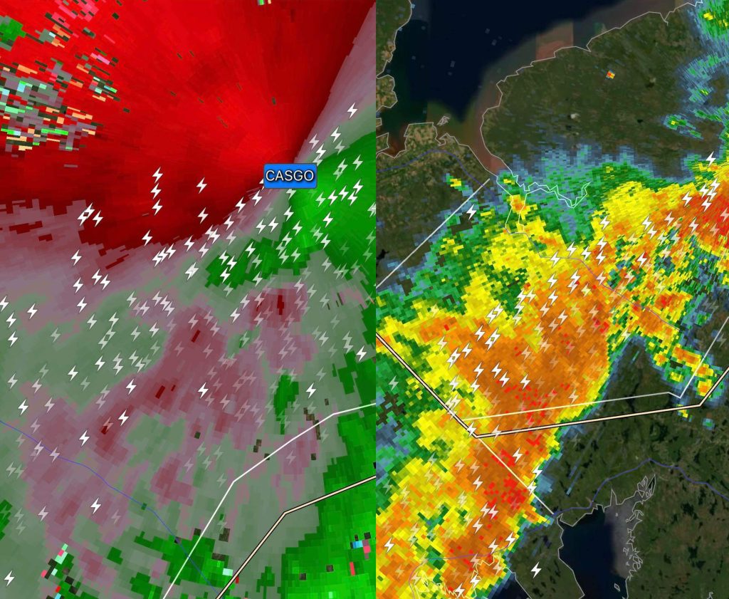
As far as I know, there was no reports of a tornado however the outcome was massive amounts of lightning and rain. As someone hundreds of kilometers away, the massive amounts of rain would cause flooding and end up sadly costing people their lives.
For Jessica, she reported the lightning was constant.
The next day, I was en route to Nova Scotia to capture some landscape images. As such, I brought my normal landscape gear (2x A7R IV’s, my main landscape lenses). It was to be a day trip so I didn’t bring my laptop or anything else for processing images.
My goal was to capture some a train image for my 2025 Canadian Trains calendar as well as a scenic photo of Northern mainland Nova Scotia was for my 2025 Nova Scotia calendar. I ended up coming across more than I bargained for.

A section of the train track near Truro was washed away. This was the main line that trains departing Halifax, Nova Scotia use. Around the same time, there was a strike impacting the Port of Vancouver which is a major entry of goods into Canada. Ships coming from oversea’s drop the containers off at the Port of Vancouver where the goods are put onto rail lines and shipped across Canada. The same thing happens in Halifax leaving 2 major port’s of entry being impacted at the exact same time. As such, I thought this was a rather significant development.
Nearby a CN Rail staff member was talking to someone about the destruction. I joined in to listen. They asked who I was and I introduced myself as a landscape and editorial photographer who just stumbled across this. I explained I wasn’t working but was curious.
As I was standing looking at the damaged rail line, I texted one of the Reuter’s editors about the development on the East Coast. After a conversation about the situation, I was asked to create some imagery as a result of the storms tho I had an issue. I didn’t have a laptop to regularly file so in the end, I was going to live file. Directly from my camera to Reuters.
Easy I thought. Going directly from my camera which was connected to my iPhone and sending them right to the photo editors. The difficult part would be finding where the worst of the worst was.
I ended up going back to the CN Rail folks involved in the conversation with a few public individuals. I explained I was now tasked with covering this.

Shortly after I sent in the first photo, full time Chronicle Herald photojournalist Tim Krochak showed up. He was off on this particular day. We chatted about the damage he had seen around Halifax and he shared that he heard near Windsor was apparently really bad. I captured a few images and started to head South towards Halifax. I was thinking I would go towards Halifax (about an hour away) and hopefully capture some good stuff there. If not, I’d drive another 30-45 minutes to Windsor.
I wasn’t sure what I would see but I figured I’d avoid the main highway to Halifax as if there was a significant development there, it would went viral on social media really quick.


As I continued in Halifax near the Sunnyside mall, I came across some more evidence of the floods.

I eventually came to a bridge which was closed. There had been some questions around the integrity of the bridge and it was deemed not safe to be on it. While talking with the security personal, someone from the fire department came. I ended up capturing some imagery of the fireman walking on the bridge.
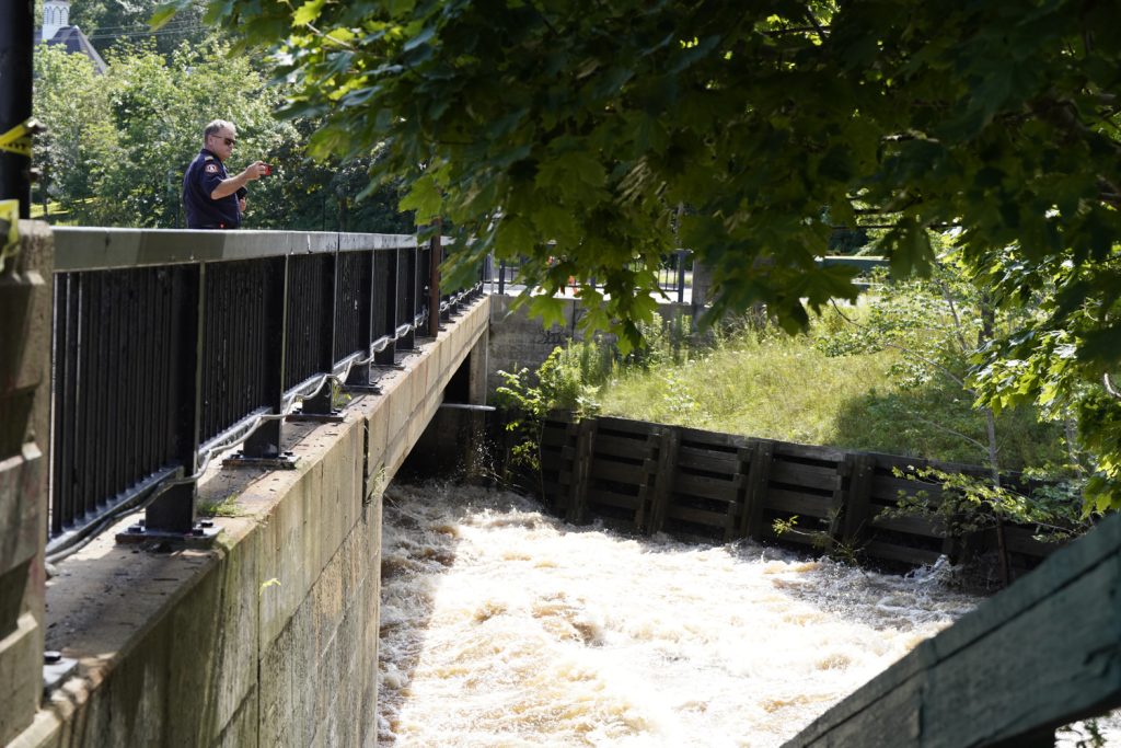
I ran up a small hill to capture some imagery of the fireman walking along the bridge, I wasn’t sure if there was anything significant about this bridge or not and nor was the security personal.
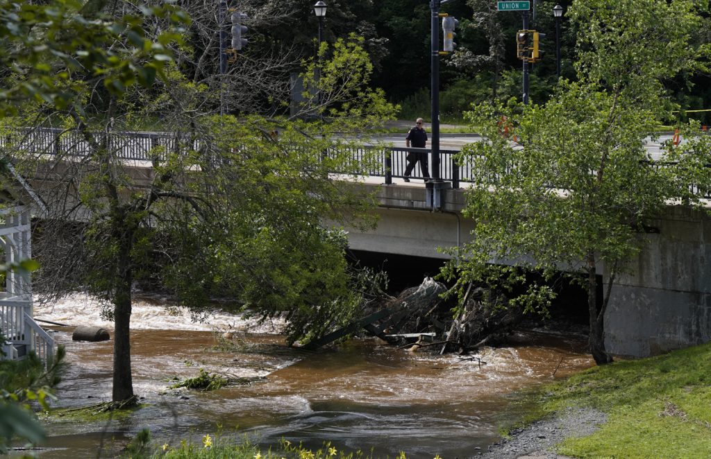
By this point, I wasn’t really happy with what I had captured. My imagery was so far weak. I didn’t see the destruction I was expecting yet. I ended up chatting with the fire official who also mentioned he heard Windsor area was hit pretty bad.
I drove around to the other side of the above bridge, where another bridge was located. The area I was heading to was lower to the water so there might be some more destruction.
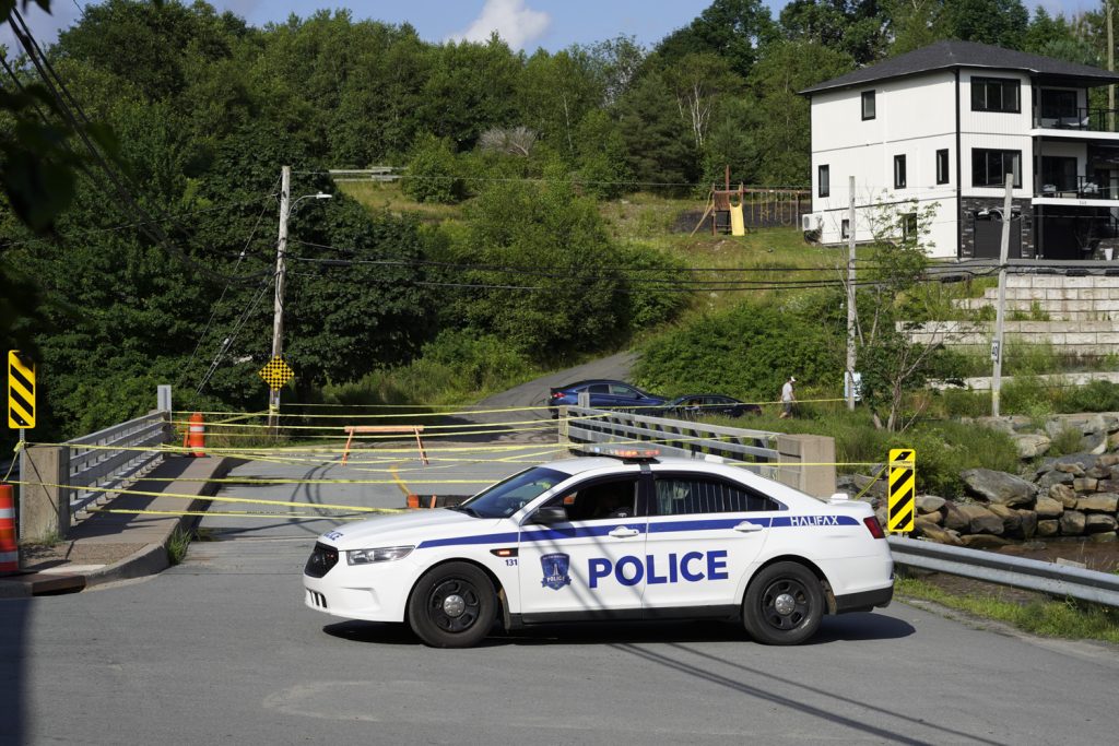
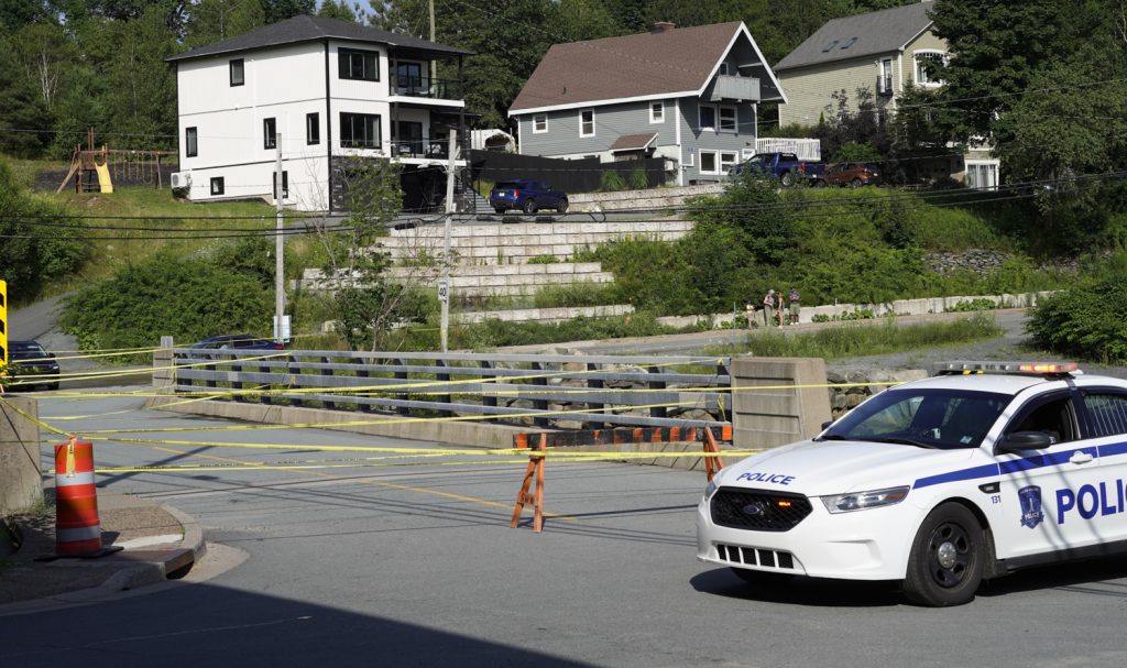
By this point I was a couple hours in and only produced some weak imagery. I also had some issues live filling which I was trying to sort out with my camera. I stopped by this police car and figured out what was going wrong. Of course, it was within the settings. I figured it out and filled some images. While doing so I watched as some folks climbed the steep hill to cross over to the other side of this bridge via the rail bridge above us. I followed, hoping to capture something.

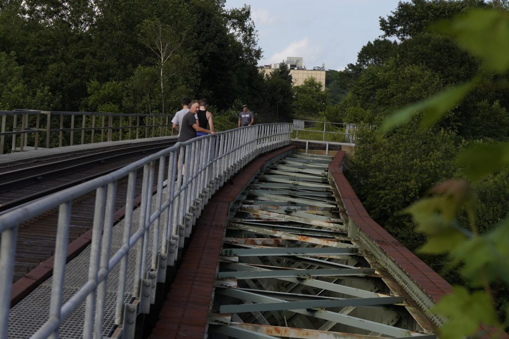
Still nothing good. As a photojournalist covering this for a major international agency, it started to take its toll on me. I was in all the wrong spots. I said enough was enough. None of the imagery I had captured was good enough to make the cover of the Globe & Mail. I knew this but was struggling to find the massive destruction I was expecting.
Go West, young man
This phrase was legendary but I always remember my uncle Chuck saying it many times before he passed away. Off I went, I was heading to the third destination that was 45 minutes – 60 minutes away. I had previously written down notes of some spots that others thought may have some destruction and started heading that way.
There wasn’t much traffic on the roads but I definitely wasn’t familiar with this area.
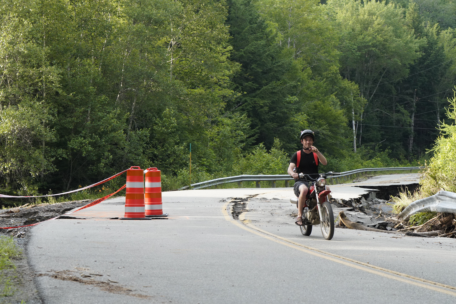
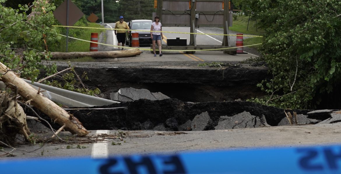
After about an hour of driving, I came across this first scene. I immediately thought my luck was about to change. This damaged road was worse than any scene I had been to in Halifax.
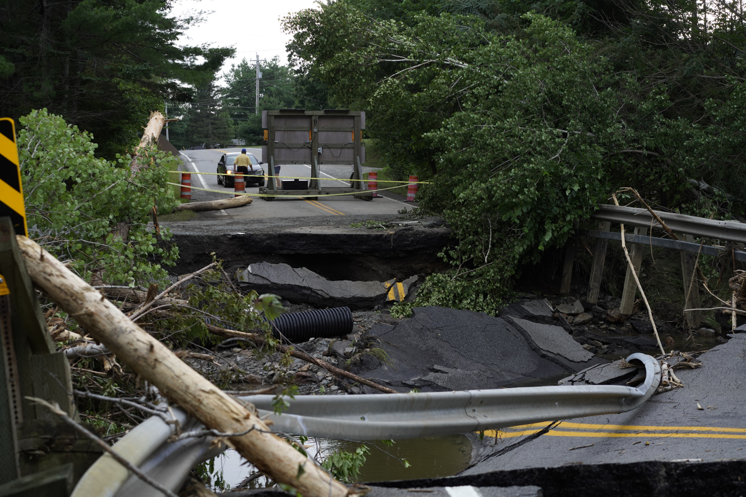
After a while more driving, I came across another washed out bridge. I felt more confident I was on the right path.
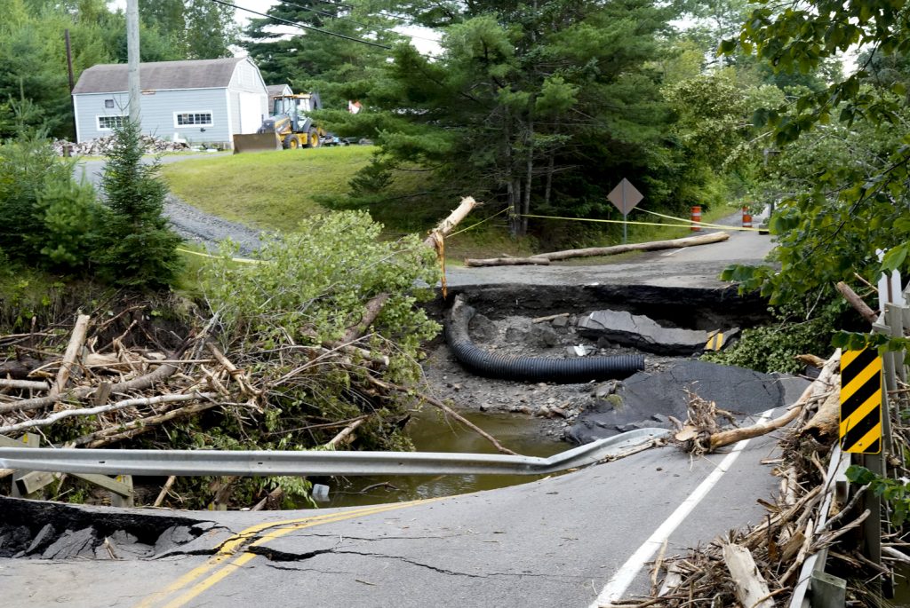
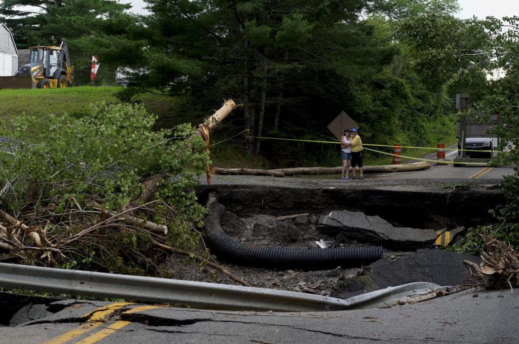
I snapped the above photo and attempted to live file. I was again having issues. This time, it would be with the cell phone service. I wasn’t sure why they were filing and spent some time attempting to troubleshoot it. As I did, a couple drove up in their car to checkout the destruction.
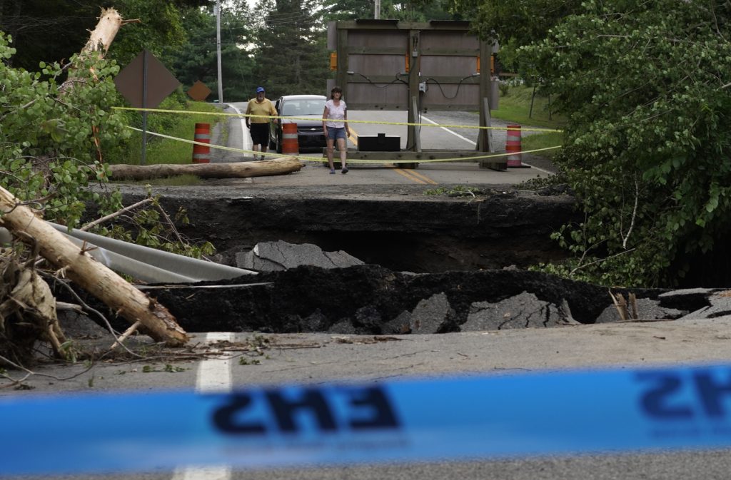
I waited and captured multiple images of the couple. Sure enough, they moved around. They were close enough I could hear the conversation. They were speaking about how Nova Scotia had been through so much. Their home province was devastated by massive wild fires a month prior. Now they were being impacted by 200-300mm of rain that fell in a 24 hour period. That’s 9.8 inches of rain.
My heart hurt for them.
I continued on further down the road. I was getting closer to an area where there was four people missing. Search & Rescue crews were searching the area for the four individuals.
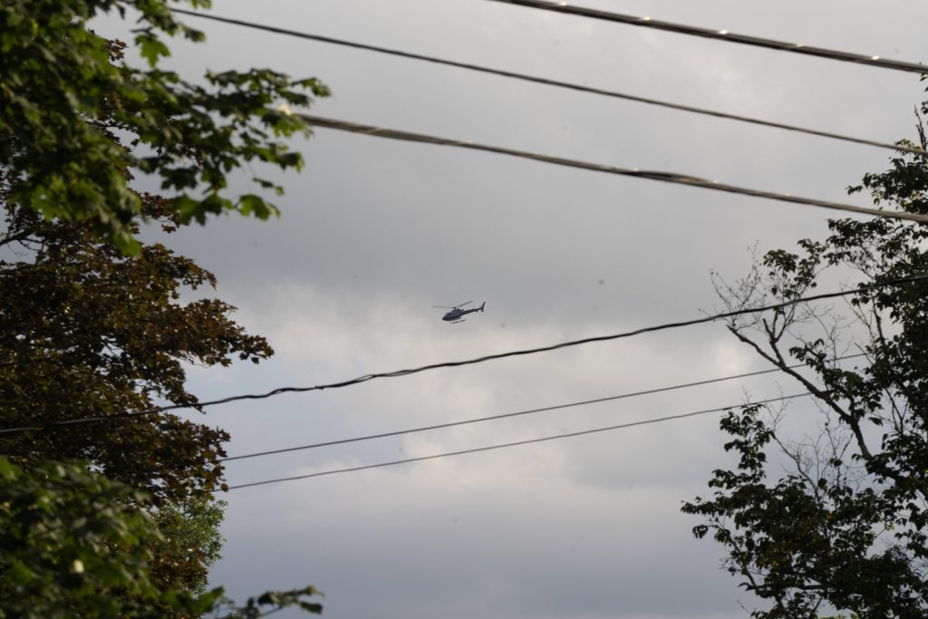
Struggling to live file, I continued moving thinking I may win the jackpot. I might find another scene while having good cell phone service.

With 3-4 bars on LTE service, I thought that was weird. I have good cell phone service according to the bars but I couldn’t hear anything. I proceeded to attempt to send in the images. No go. At this stage I was becoming frustrated. My images were sending so I figured I would go and find good cell phone service.
I spent 20-30 minutes driving around. Eventually I started to hear towards the largest community, Windsor. While doing so, my phone flashed full bars a couple of times. As it did, I was driving by a hill. I drove up the hill to ensure I had the best cell phone service possible. Full bars and all a sudden a ton of messages started to come in. I immediately filled the images. While they were being uploaded, I took a photo with my phone.
This ended up concluding my coverage of the Nova Scotia floods and I started to drive back to Charlottetown. For me, I thought this was the end of my coverage of the floods but sure enough, 24 hours later the Globe & Mail would ask me to go back.

The Globe and Mail would end up writing about the spotty cell phone service using one of my Reuters photographs.
As captured for Reuters and seen around the world including Al Jazeera, NASAQ and the Globe & Mail (2).

